Code: MEAPONOR Duration: 14 days

The word Apolobamba (originally spelled Apullupampa) comes from the words Apu=Gods in the Indian religion and Pampa=flat land, literally meaning the flat lands where the mountain gods live.
These lands have hosted several cultures through the centuries, the most known the Kallawayas, itinerant healers that still survive in the lower mountain valleys. To travel to this area is like traveling to the past ... almost to another dimension where time and space have different measures.
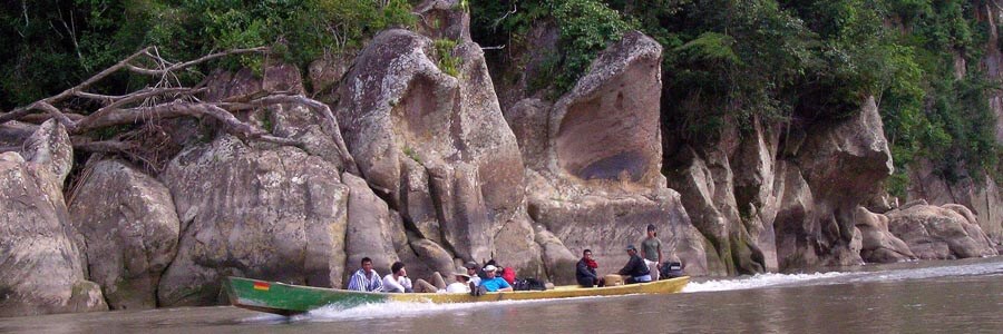
In the recent past, Apolobamba National Park, Ulla Ulla Vicuña Reserve and Madidi National Park have been engulfed into one huge protected area which covers all of the ecological steps in the Andes and the Amazon: from the high glaciated mountains down into the very Amazon rain forest.
The expedition starts with an initial acclimatization process hiking Lake Titicaca shores and islands, then we head towards Apolobamba for the high-altitude acclimatization in a very seldom visited region, to finish climbing Chaupiorko - the highest peak in Apolobamba - by the a new route we recently open vie the south ridge.
Short Itinerary
Day 1. Arrival in La Paz. Transfer to Hotel.
Day 2. Hike on Peñas. Transport to Copacabana. Hotel.
Day 3. Trek Sun Island .Transp.Huatajata. Hotel
Day 4. Transp.to Kota Pikiña. Camp
Day 5. Climb to Altarani ridge. Transport to Cerro Hermoso. Camp
Day 6. Mountaineering techniques Practice. Camp
Day 7. Climb Minasa. Trek to suches. Camp
Day 8. Rest day. Camp.
Day 9. Trek to Chucuyo. Camp.
Day 10. Climb to High Camp. Camp.
Day 11. Climb of ChaupiOrko. Trek to Chucuyo. Camp.
Day 12. Trek to Suches. Camp
Day 13. Transp.to La Paz. Hotel
Day 14. Departure. Transfer to Airport.
Highlights
- Acclimatization sightseeing Lake Titicaca & surroundings.
- Rock & ice practice and instruction before the climbs.
- Ascents to two pristine summits in Apolobamba: Minasa peak 5,266m and Chaupi Orko 6,088m.
- Traveling through the land of the famous Andean witch doctors; the Kallawayas.
Services Included
- All transfers IN/OUT to airports.
- Meals mentioned in the itinerary.
- Full land transportation during the trip.
- Hotel accommodation as mentioned in the itinerary.
- Common camping equipment: 3 season tents, dinning and kitchen tents, Kitchenware & tableware.
- Common climbing equipment: ropes, carabiners, slings, snow stakes, ice screws.
- Professional bilingual UIAGM / IFMGA / IVBV certified mountain guide.
- Luggage transportation with porters and/or animals (15 kg/33 lb per person max weight).
- Cook when camping.
- National Park entrance fees.
Services Not Included
- International & local flight tickets & fees.
- Meals while in La Paz, Copacabana and other main cities.
- Personal camping equipment: sleeping bag, mattress, headlamps, and clothing.
- Personal climbing equipment: plastic boots, crampons, harnesses, ice axe.
- Insurance of any kind.
- Any expense due to a rescue operation (rescuers fee, transportation, or medical cost).
Day to day details
Arriving at the airport in La Paz your breath will be taken away. Not just because of the altitude; the airport is the highest international airport in the world; but also because of the views over the mountains. The crisp clear sky of the highlands give the impression you could touch them. In a normal winter day it is possible to see over a distance of 200Km (120mi). The cold and dry air feels good after so many hours of treated pressurized cabin air.
The drive to the city of La Paz is not less impressive. We will stop at “La Ceja” (literally the eyebrow in Spanish; but also meaning the edge) and have a view on the amazing city with buildings and houses hanging from the steep slopes and filling the whole valley that is surrounded by huge glaciated mountains.
Then we will descend 500m (1640ft) down to our hotel in downtown. Do not get stressed much about the altitude; our program has been designed to get you gradually acclimatized. At the beginning we strongly suggest you to take it very easy, drink plenty of water and eat lightly (get into out Acclimatization page for more information).
You will have the rest of the day free. At early evening we will have a briefing meeting.
Overnight: Hotel Nayra
El Alto: 4,100m (13,450ft)
La Paz: 3,650m (11,972ft)
Driving: 30 min (11km)
None
After breakfast we will take our transport and head north towards Lake Titicaca. Half of the way we will do our first hike in a small rocky range called Peñas located in from of Cordillera Real; the view from the top is just breathtaking. If the day is clear, we may even take a lock of Apolobamba range in the distance. After the hike, we will take our vehicle and get to the shores of the lake where we will stay in one of the best hotels in the area.
Traveling through this land it is easy to understand how important the shores of Lake Titicaca have been in the development of Andean cultures. Surrounded by desert like hills and snow capped mountains, the lake offered, and still offers, rich lands and a mild climate. On the way to Copacabana, we will be culturally transferred to the past as we go by Aymara villages where Indians have been keeping their lifestyle for centuries.
Overnight: Hotel Rosario del Lago
Trailhead: 4,011m (13,156ft)
Peñas: 4,333m (14,212ft)
Lake Titicaca: 3,810m (12,497ft)
Driving: 4-5Hrs (185km)
Walking: 3-4Hrs (4km)
B,L
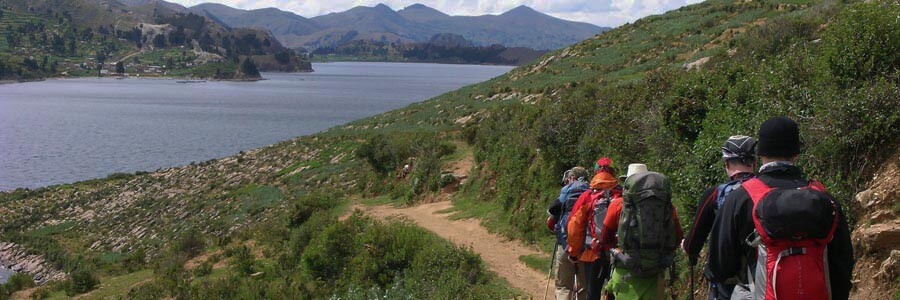
After a short pleasant drive along of the shores of Copacabana peninsula, we will get to the village of Yampupata where we will board the motor boat that will take us to the Island of the Sun. Today we will trek the length of the island admiring the Inca terraces, many of which are still used, passing through villages and walking along sandy beaches. Our objective is to reach the north-west end of the island where we can visit a sacred rock, which was worshipped as the birthplace of the first Incas: Manco Kapac and Mama Okllo, son and daughter of Viracocha. We will also have time to visit the ruins of Chincana(the labyrinth). The bravest may try a bath in the cold waters of the lake. At mid afternoon we will retrace our way to mainland. Our vehicle will take us to another Indian Village at the lake shores: Huatajata. The mountains will “grow” in front of us dominating the landscape and the glaciers will get “tanned” by the late afternoon light as we approach to our hotel.
Overnight: Hotel Inca Utama
Island of the sun: 4,065m (13,333ft)
Chincana: 3,830m (12,529ft)
Huatajata: 3,810m (12,497ft)
Walking: 3-4Hrs (11km)
Motor boat: 2-3Hrs (13km)
Driving: 4-5Hrs (100km)
B,L,D
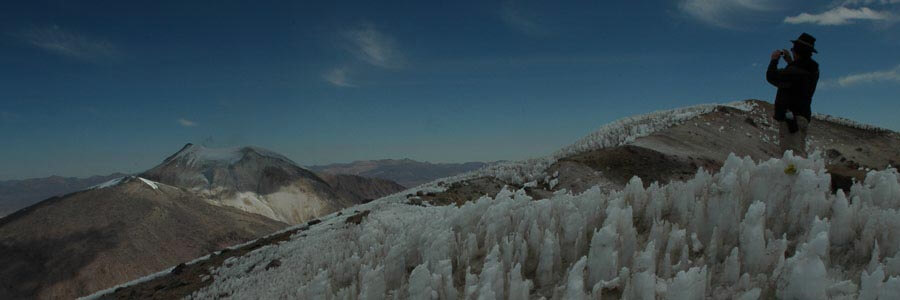
Normally driving all day long could be really boring and tiring, but not towards Apolobamba. The road follows the eastern shores of Lake Titicaca and afterwards gets into the rolling hills of Muñecas mountain range. As the rocks change colors and the lakes shown their colored waters, the car runs into the Ulla Ulla plateau, the largest Vicuña reserve in Bolivia. Thousands of wild animals run in front of glaciated peaks and colorful lakes; our campsite will be located at the head of lake Cololo, one of largest in Apolobamba.
Overnight: Camping
Kota Pikiña: 4,609m (15,117ft)
Driving: 8-9Hrs (278km)
B,L,D
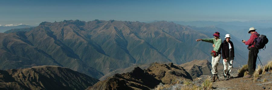
In order to start our acclimatization process today we will ascend to a rocky ridge facing the mountains of Altarani valley, from the top we will enjoy one of the most spectacular views of Apolobamba including Chaupi Orko towards the north. After getting to the highest point, we will descend in to the Pelechuco valley where we will camp near to an old mining campsite called Cerro Hermoso campsite; on the way we will cross Katantica pass with its breathtaking views.
Overnight: Camping
Altarani ridge: 5,107m (16,750ft)
Kota Pikiña: 4,609m (15,117ft)
Katantica pass: 4,860m (15,946ft)
Cerro Hermoso: 4,756m (15,600ft)
Walking: 4-5Hrs (11km)
B,L,D
After hiking up through moraines, we will arrive to the lower glacier of Cerro Hermoso and start our practice day. Some subjects to be review are: rope handle and knots, crampon and ice axe techniques, and - if there is some time left -, some crevasse rescue techniques. At the end of the afternoon we will get back to our camp.
Overnight: Camping
Glacier: 5,150m (16,892ft)
Cerro Hermoso: 4,756m (15,600ft)
Walking: 2-3Hrs (5km)
B,L,D
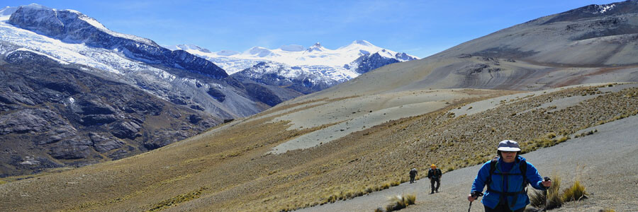
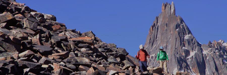
After breakfast our vehicle will transport us back up to Katantica pass from where we will start hiking through moraines and scree towards Minasa peak. The lower part of the glacier is not too steep and there are few crevasses to cross, then we will climb straight forward steep the south ridge. From the top of this peak we will have one of the most astonishing views of the trip, and later descend to our new campsite located near the shores of Lake Suches; the biggest lake of Apolobamba.
Overnight: Camping
Minasa peak: 5,266m (17,272ft)
Suches camp: 4,700m (15,421ft)
Driving: 30Min (3km)
Walking: 8-9Hrs (11km)
B,L,D
A well-deserved rest day will allow regaining our strength and getting ready for the following days. The activities of today can be hiking the campsite surroundings; play cards, or just relax and read.
Overnight: Camping
Suches camp: 4,700m (15,421ft)
None
B,L,D
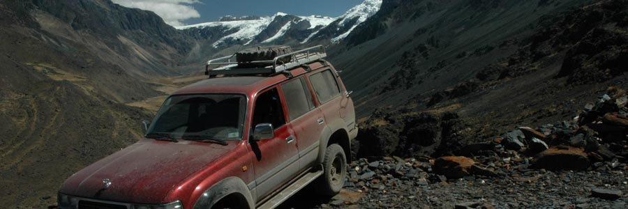
The approaching route towards Chaupi Orko base camp goes through a very rough terrain that is very seldom visited by foreigners. As far as we know, all attempts to climb this mountain are organized by the eastern slopes following the traditional but not necessarily easier or most scenic route. Our campsite will be located at the shores of a beautiful glacier lagoon in a remote hidden valley on the southern slopes of the peak.
Overnight: Camping
Chucuyo: 5,100m (16,321ft)
Walking: 5-6Hrs (8km)
B,L,D
After organizing our loads with the high-altitude porters, we will start the ascent first between rocks and moraines, and later to the edge of the glacier from where we will rope-up and continue ascending towards our high camp.
Overnight: Camping
Chaupi Orko HC: 5,456m (17,895ft)
Walking: 6-7Hrs (3km)
B,L,D
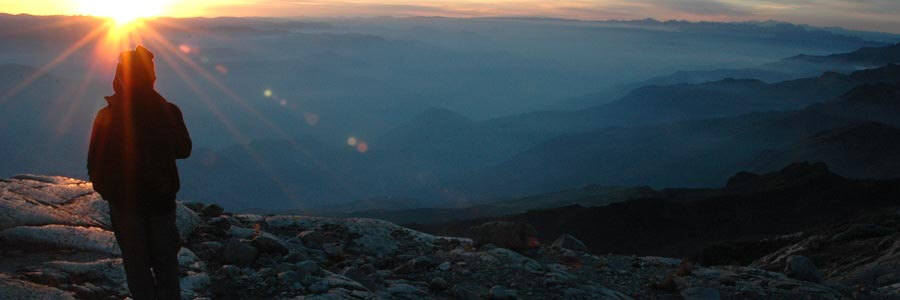
We have to make an early alpine start if we want to get back to the base camp tonight. And normally that is what everyone wants after spending an uneasy night at high camp. After traversing a glacier plateau, we have to descend to the base of the southeast ridge. The route on this ridge is very long but, most of it is not really technical. There we do not expect many technical complications but this will depend on the ice and snow conditions. The crux of the route is an open “bergsrung” just before a steep icy slope at 60°.
Overnight: Camping
Chaupi Orko: 6,088m (19,968ft)
Chucuyo: 5,100m (16,321ft)
Walking: 10-12 Hrs (6.5km)
B,L,D
With the help of our porters, we will retrace our steeps back towards Lake Suches where our campsite will be ready. If we arrive to Suches camp early in the day, we may consider moving the campsite closer towards La Paz city.
Overnight: Camping
Suches camp: 4,700m (15,421ft)
Walking: 4-5Hrs (8km)
B,L,D
Our vehicle will take us back to La Paz following the same route we came in … it always seems it was long time ago.
Overnight: Hotel Nayra
Road pass: 5.100m (16,728ft)
La Paz: 3,650m (11,972ft)
Driving: 8-10Hrs (290km)
B,L
Transfer to airport.
Overnight: None
El Alto: 4,100m (13,450ft)
Driving: 30Min (11km)
None

