The wide range of latitudes that the South American continent occupies from north to south, the influence of the two oceans (Atlantic and Pacific) both with different temperatures in each side of the continent, the complicated topography along of the Andes - one of the highest and longest mountain chains in the planet -, explains accordingly the great variety of the weather in South America. On top of this, as everywhere else in the planet we are suffering of severe glacier receding and changes in the weather due to green house effect and holes in the ozone layer.
Climates can be very varied but - generally speaking -, we can mention the following: the hot and humid Amazon basin and Caribbean, the cold and dry winds of Patagonia, the extreme dryness of Atacama desert, the gelid winds of Tierra del Fuego, the warm temperature of microclimatic valleys "trapped" by the Andes, the hot and dry "Chaco" forest between Bolivia and Argentina, the coldness of the glaciers and snowfields of the Andean mountains.
The area of our operations, the central Andes, has a great variety of climates and weather, but we could say that there are two main regions: one inside the tropics and the other below the Capricorn Tropic line, in the temperate zone. Nevertheless there are local differences that have to be considered at the time of travelling to the southern part of South America: at the same latitude it is possible to find extremely dry deserts, high altitude glaciers and extremely humid forests.
Even though we learn at our schools that there are four seasons at the southern hemisphere: winter (June to September), spring (September to December), summer (December to March), and autumn (March to June), the reality is that we in the central Andes there are only two clearly differentiated seasons: rainy season (January to March) and dry season (April to December).
Depending of the area, the Rainy season may start as early as September, and extend as late as April. The precipitation varies depending not only in altitude but in geographical location. There is plenty of rain in the cloud forest and Amazon basin (over 5000 mm per year in some areas), not too much in the south-western highlands (as little as 100 mm per year), and almost nothing along the coastal deserts in Peru and the Atacama desert in Chile (less than 30 mm per year). There may be occasional rains (snow storms in the mountains) during the dry season due to cold fronts form the south.
Temperature can range from 35º C (95º F) or more in some places of the Amazon basin, down to -40º (-40º F) or less in the mountains close to the Atacama Desert. Both extremes can be enhanced by certain local atmospheric conditions like: extreme dryness with practically no winds in one hand or strong winds with high concentration of humidity.
Geographically speaking there are five regions in which we organize our trips:
- The tectonic mountain ranges in Peru and Bolivia: Apolobamaba, Cordillera Real and Quimsa Cruz ranges.
- The volcanoes in Peru, Chile and Bolivia: Volcanic range or Cordillera Occidental.
- The high plateau or Altiplano, mainly in Bolivian territory.
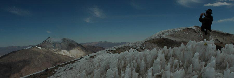
- The high cold deserts in Bolivia and Chile (Atacama).
- The temperate microclimatic valleys trapped into the Andean range.
- The cloud forest and Amazon basin shared by Peru and Bolivia.
“El Niño” and “La Niña”
“El Niño Southern Oscillation” (ENSO), happens every 4 to 7 years and affects the whole planet, particularly the southern hemisphere. This phenomenon produces several climatic changes of a variety of conditions. In 1997-1998, it brought a drought to the mountains that lead to an important recession of the Andean glaciers. During 1999 and 2000, we have had an unstable weather due to the opposite phenomenon, La Niña. During 2001 weather patterns were relatively regular. 2002 through 2005 weather patherns just drove us crazy. We have had the most erratic and unpredictable weather patterns ever recorded in this part of the world. The Andean highlands have been dramatically affected by bad weather (extremely heavy snow storms, avalanches and a disastrous hail storm in La Paz - Bolivia). At the end of 2007 "La Niña" started again, very heavy rains produced severe floods not only in the lowlands but also in the northern highlands. Some scientists expect that in the future weather patterns will became even more unpredictable and we may have heavy rains and a lot of snow. That will mean a new drought in the Bolivian highlands. If “El Niño” brings some instability in the mountains, on the other hand, brings warm streams in the Pacific Ocean, making all the coast warm, and good for traveling and water sports.
Highlands, cold deserts & mountains
The weather in the highlands is normally dry, and cold. During the dry season - if there is not much wind -, days can get warm. Nights are always very cold. It normally gets below freezing point. In the southern hemisphere, some things happen in the opposite way than in the Northern. Here the further south you go, the colder. During the wet season, days can be hot, except when it rains. Nights are mild and only occasionally will get down to freezing point.
Because of the altitude, latitude, and unprotected expanses at the highlands we can experience all seasons in a single day: freezing cold during the night (Winter), temperate at early morning (Spring), warm or even hot at noon (Summer) and cool and windy in late afternoon (Autumn).
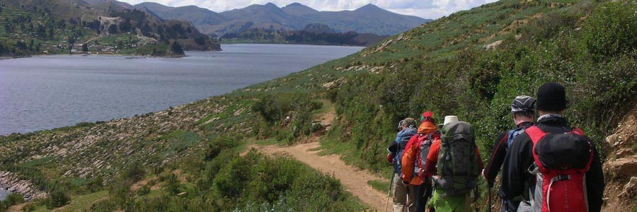
The High plateau, where the Lake Titicaca and the cities of Puno, La Paz, Oruro, and Potosi are located, sit at an average altitude of 4000 m (13120 ft), with variable elevations from snow glaciated mountains as high as to 6549 m (21480 ft) to the vast Uyuni Salt Flats hovering at a mere of 3580 m (11742 ft). Lake Titicaca provides humidity in the air, thus creating a microclimate in the region, colder at night but warmer during the day than the rest of the High plateau, temperatures in summer rise to 25°C (77°F).
In La Paz in summertime temperatures ranges from 5º C to 20º C (41º F to 68º F), while during winter it drops down between 0º C and 16º C (32º and 61º F).
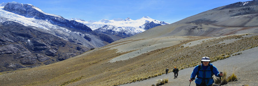
High up in the mountains (Blanca, Huaywash, Vilcanota, Apolobamaba, Cordillera Real And Quimsa Cruz ranges) temperature can exceptionally be as low as -20º C (-4º F), normally ranging between 5º C to 15º (41º F to 59º F) during the day and -5º C to -10º C (23º F to 14º F) during the night.
Farther south in the Atacama desert and Uyuni salt flats, temperatures are more extreme, range from 30º C / 86º F during the summer, down to -25º C (-13º F) during winter, with an average temperature of 6º C (43º F). In the extreme south, very Strong winds can produce a chill effect of -40º C (-40º F).
We have to consider that there are several areas clearly different:
- The high so called Eastern range, including Cordillera Blanca, Huayhash, Vilcanota and Apolobamba in Peru, Apolobamba, Real and Quimsa Cruz in Bolivia, are to be best visited in winter time (dry time), from April to September. The rest of the year the rains arrive and travelling to the mountains and jungles can get uncomfortable but still possible.
- The Sajama and Lauca National Parks in Bolivia and Chile respectively, have also the same timeline as the Eastern range. It might be widen by a month at both ends, but that depends on the year.
- The mountain range that makes border between Chile with Bolivia and Northern Chile with Argentina can be visited all year round. Winter can get extremely cold but mostly dry. Temperatures can get as low as –20 C on the campsites and refuges and –30 or 40 on the peaks and high passes.
- The Central Chilean-Argentinean Andes. Including the biggest mountains of South America like Ojos del Salado and Aconcagua, are best visited in summertime, end of November to February, sometimes even March. Patagonia and Tierra del Fuego, are also places to visit during the austral summer.
Atacama Desert
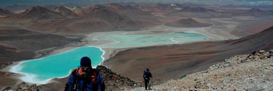
It is possible to travel all year round. It is considered the driest place on earth besides Antarctic. On the same timing can be considered the high and cold Bolivian and Argentinean deserts, including Laguna Colorada and Laguna Verde.
The high so called Eastern range, including Cordillera Blanca, Huayhash, Vilcanota and Apolobamba in Peru, Apolobamba, Real and Quimsa Cruz in Bolivia, are to be best visited in winter time (dry time), from April to September. The rest of the year the rains arrive and travelling to the mountains and jungles can get uncomfortable but still possible.
Mediterranean climate valleys
Those valleys, located between 1000m (3280 ft) and 2500m (8200 ft), have some of the most pleasant climates in the Andes. The temperate Mediterranean-like climate make this region a favourite to spend vacations or take a rest after hard adventure trips in warm to hot days and pleasant night time temperatures. That region is where the majority of the fruit and vegetables come from.
The temperate valleys, where the cities of Cochabamba, Sucre, and Tarija, are located, sit at an average altitude of 2500 m (8200 ft) down to the riverbeds at 1000 m (3280 ft).
There is not much difference between summer and winter temperatures varying from 10º C (0º F) to 30º C (86º F).
Cloud forest and Amazon basin
The Cloud Forest is located on the eastern side of the Andes (between the mountain ranges and the upper Amazon basin). These areas make a shield to the humid currents that rise from the Amazonian jungle. Between 1.000m (3.280ft) to 3.500m (11.480ft) there exists a thermal inversion zone. This area condenses the rising humidity to create humid forests.
Weather is normally humid and hot. During the dry season, days are warm to hot, and nights mild. During the wet season there is a lot of rain (it rains almost every day and all day long), days and nights can be very hot and humid.
The Tropical Lowlands, which make most of the north and west Bolivian territory, are composed of the Amazon basin and the “Rio de la Plata” basin. These areas have a variety of ecosystems and in general they are hot and humid year round.
During the rainy season the rain is constant and torrential downpours are the norm (it will probably rain everyday and all day long), flooding is a normal part of the process which is also very important for this ecosystem.
Temperatures are normally about 25ºC (77ºF) to 30ºC (86ºF) with peak temperatures as hot as 40ºC (104ºF). Occasionally bitterly cold winds (called “Surazos”) come up from Patagonia and the Argentinean plains, this winds plus the humidity in the region drop the temperature down and may produce freezing chill effect even though it will never get to freezing point.
The Amazon Rainforest sits at an average altitude of 400 m (1312 ft).
Gran Chaco plains
This extremely dry and hot area is generally flat with some rolling hills, valleys and few rivers that drain the sparse landscape. Most of the vegetation (short bushes, thorny branches, coarse grasses, cactus, and few scattered large trees) has been adapted to the very hot temperatures and low humidity. Since it is so inhospitable, few people live here and so the abundance of wildlife is varied and abundant.
Seasons to travel by activity
4WD Expeditions
Travelling by car in the southern highland deserts (Uyuni Salt Flats and Atacama desert) may be possible almost all year around, even during the rainy season (typically from January to March). Check about weather conditions before signing for a trip, sometimes the salt flats get flooded, or there are snow storms in the highlands.
The rest of the highlands in the central Andes, are feasible almost all year round if you drive on main roads and highways. Secondary roads can get very difficult during the rainy season because of land slices, grown mountain rivers and muddy roads.
Flooding, grown rivers and muddy roads make travelling to the Cloud forest or the Amazon basin very difficult or almost impossible during the rainy season.
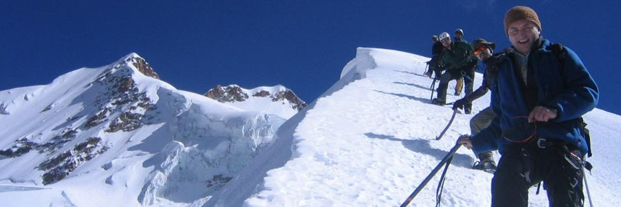
Mounteineering Expeditions (from north to south)
Mountaineering in Venezuela and Colombia at the extreme north of the Andes (Merida and Cocuy), is better from December through February.
Volcano climbing in Ecuador can be done from June through February, depending of the distance of the mountain to the pacific or to the Amazon basin.
Northern mountain ranges in Peru (Blanca and Huayhuash), better to be accessed from June and July during the winter. Usually, Peruvian mountain ranges gets more snow during the rainy season; therefore, there is more danger of avalanche from January through March and even in June.
Eastern ranges in Peru (Vilcanota and Apolobamba) and Bolivia (Apolobamba, Cordillera Real and Quimsa Cruz), extends from May through September. From June to August (winter) the weather is very stable. From May to June you can find the best snow conditions in the mountains. From October to December, the weather becomes more unpredictable and there may be some early rains.
Volcano climbing in Bolivian, Peru and Chile (Volcanic range and Atacama) is possible almost all year around. Check about weather conditions before signing for a trip, sometimes the salt flats get flooded, or there are snowstorms in the highlands and volcanoes.
Further south in Mendoza region, climbing season better from January to February, although it can extent through March. Because of its latitude, weather conditions in Aconcagua can get extremely rough.
Trekking
Most trekkers come during our winter (June to August) because the weather is more stable at this time but temperature can get very low. Just before the winter and after the rainy season, April and May, temperatures are mild, and - the best of all - there is very few people on the trails. Trekking during the rainy season (specially in the forested areas), may be difficult and sometimes dangerous because of: flooding, grown rivers, muddy trails, and potential land slides.
Rafting descents
Rafting trips are organized just after the rainy season (April to May) because there is plenty of water in the rivers. During and after winter (June to November) there is not much water in the rivers, therefore descents may be very technical or complicated. From December to March (the rainy season) the rivers get total flood and get very hazardous as they carry big stones and trees.
Sea Kayaking
It is possible to kayak all year-around on Lake Titicaca. During the rainy season, from January to March, there may be some rains especially during the night. Winds can be a serious problem during our winter, especially in August. Kayaking on the Pacific is better in summer.