 Tectonic pressures and volcanic activity gave shape the earth, South America been lifted up from sea levels, started showing the mountains we climb this days.
The Nazca plate in the base of the Pacific Ocean and the Brazilian Shield crashed together and created mountain structures. A large portion of magma was also pushed upwards by the same phenomenon. All of this aroused volcanic activity along the coast. Several volcanic cones emerged and formed most of the volcanic range. Some of the volcanoes are still active and smoke from time to time.
The rocky outcrops formed the Eastern sections of the range (including Apolobamba, Cordillera Real, and Quimsa Cruz ranges in Bolivia), and the volcanic cones made up the
Western Volcanic Range
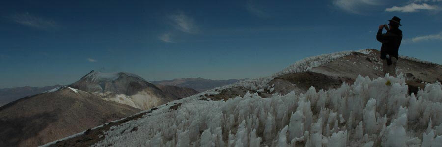
A large portion of water was trapped in between the ranges creating a huge inland sea. Eventually, the remains of this sea formed lake Titicaca, lake Poopo, and the Salt lakes of Uyuni and Coipasa, in the Bolivian high plateau. Western Volcanic Range This range (Cordillera Occidental) is composed of Cenozoic (65 million years ago to the present) volcanoes, domes, flows, ignimbrites (huge hot ash flows), and sedimentary rocks derived from this volcanic activity. The main phrase of volcanism was about 25 to 22 million years ago during the Miocene period. There have been no volcanic eruptions recorded recently, and few of the Volcanoes are classified as active: the Ollague where there are very active fumaroles venting sulfur gases from the southern flank, the Guallatire with the biggest sulfur fumaroles arising from its glaciers, and the Putana where there is some liquid lava in its crater and Uturuncu, at present the fastest growing volcano on earth. The rest of this area, although is not consider active, its by no means extinct, since you can find several “signs” of activity like: geysers, hot springs, fumaroles’, and boiling mud puddles.
The Volcanoes in the area around Sajama are very recent with well-formed summit craters.
The whole range contains sulfur (still mined in Ollague, Uturunco and other volcanoes) and borate. The mining of both represent the main economical activity of that area (exploited from lake deposits mainly to make detergents). Nowadays there are numerous mining companies exploring the volcanoes for gold and silver. Although our government have not confirmed it, Uranium have been discovered recently but it is not being extracted yet.
Eastern mountain range
The Cordillera Oriental is composed primarily of sedimentary rocks from the Paleozoic and Mesozoic eras (600-225 million and 225-65 million years ago respectively), with occasional more recent intrusive and volcanic centers. The rocks run the gamut of sedimentary rocks, including: sandstones, siltstones, shales, limestones, and quartzites. Volumetrically and economically, Ordovician and Silurian shales and siltstones are probably the most important sequences (formed 500-440 million and 440-395 million years age, respectively).
This mountain range is a classic locality to study structural and sedimentary geology: several cataclysmic episodes of deformation have helped shaping it, and low-angle thrust faults occur throughout the area (this type of fault decapitates entire ranges and moves massive amounts of rock several kilometers).
Mining has been taken place in that area for centuries. It is one of the most strongly mineralized mountain chains in the world, referred to as a metallogenic province. Mines and deposits show strong mineralogical zoning with a wide, heavily exploited tin-silver belt running down to the western side of the mountains. A parallel gold-antimony belt just east of the classic tin-silver belt is flanked on the far eastern side by a wide lead-zinc-silver belt. These belts are only tens of kilometers wide but are hundreds of kilometers long, running northwest to southeast. A number of theories have been proposed about the cause of this zoning, but has not been fully explained.
The highest peaks, such as Illimani, Illampu and Huayna Potosi are intrusive massifs (primarily granodiorite) punched up through the sediments during the Cenozoic era. Intrusive rocks such as granite and granodiorite are much more resistant to erosion than the shale and siltstones and therefore usually form the cores of the highest mountains. The entire Quimsa Cruz range is composed of granodiorite forming a towering massif over the surrounding sedimentary rocks.
Highlands & Salt Flats
This area is an elongated basin between the two main mountain ranges. In the recent geological past (only some millions of years ago), the highland was a giant canyon or fracture that has been continuously filled up with sediments derived from the two mountain ranges. At the end of the last ice age, the area hosted a large inland sea, from which lakes Titicaca and Popoo, and the Salt Flats of Uyuni and Coipasa are the remnants.
Hundreds of millions of years ago before the Andean range was formed, the today’s highlands where underwater. During that time very thick layers of salt were stored in the ocean bed, which eventually where covered by more than 3 thousand meters of sedimentary material. By the time the Bolivian Andes where already rising up, the tectonic pressure of geological plates forced the salt to outcrop through the faults because of its relatively lower density. Several salt sources are known in the highlands. Once in the surface, and after a very complicated process produced by volcanic activity, water (rivers and rainfall), glaciers during the last glacial eras, and the sun, the salt was dissolved and carried to the lowest part of the terrain; the Uyuni and Coipasa flats.
Nowadays the water flows from the Apolobamba and Real ranges, through Titicaca down to the Poopo lake. That lake has also an outlet, the river vanishes at the northern side of the Uyuni slat lake. The Uyuni and Coipasa salt Flats flood during rainy season (January to March) and dries out the rest of the year. Thousand of years ago, various glacial eras, produced huge lakes that once covered most of the highlands. Clear signs of those lakes can be found in the highlands. The lower mountains and hills of the Altiplano show cliffs that have been carved at different altitudes by prehistoric waves. Another sign of them are the fossilized algae that once lived at the bottom of the inland seas. The largest of those lakes was called: Minchin Lake that last 15000 years (from 40000 to 25000 ago), which level reached 100m (28ft) above the actual Uyuni Salt Flat level. The second largest lake was called Tauca that lasted 3000 years (from 13000 to 10000 years ago), which level was 70m (229ft) above the actual Uyuni Salt Flat level.
The deepest drilling made by scientist in the Uyuni Salt Flats is about 120m (393ft). Studies have reveled that there are 11 series of salt and sediments layers intercalate in this core sampler (actually 11 former lakes). The last of this series, which is the actual salt surface, was the Tauca lake. It stored about 6m (20ft) of salt. Thanks to explorations made by oil companies in the highlands, it is believed that this series of salt and sediments may extend to 500m (1640ft) underground.
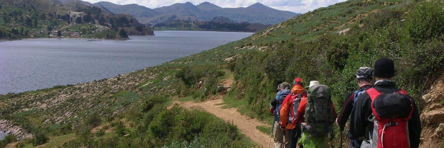
Lake Titicaca
Pushed up like all the Andes from Sea level by the tectonic forces, still having traces of Salt in its water composition.