Code: TTYUNGAC Duration: 12 days
The Andes Mountains and the cloud forest have a very close relation. They are part of the same ecosystem. It is impossible to think about one without the other even though they are so different.
This magnificent trek will take us from the shores of Lake Titicaca, across the high-glaciated Illimani massif and down into the upper rain forest. The journey will lead us through different ecological steps and therefore through several local ethnic groups lands; each one with their own particular way of being.
On this trip we will meet local Aymara people and will learn how they live in the high lands, around Lake Titicaca and the great massif of Mount Illimani. Then, after the traverse of the microclimatic valleys and the cloud forest we will get into the land of the Yungas Indians, the ones who still grow coca leaves in the higher lands of the Amazon basin. The descendents of African slaves brought during colonial times also live in this region.
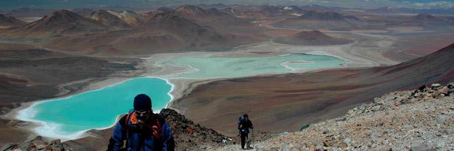
The entire traverse will show us a wide variety of animals and plants from the desert like “Altiplano” to the exuberant neo-tropical forest.
Short Itinerary
Day 1. Arrival to La Paz. Transfer IN. Hotel.
Day 2. Hike on Peñas Range. Transport to Copacabana. Hotel.
Day 3. Trek to Chincana. Transport to La Paz. Hotel
Day 4. Transport to Pinaya. Trek to Tojra. Camp.
Day 5. Trek to Kosuma river. Camp.
Day 6. Trek to Jokoyo valley. Camp.
Day 7. Trek to Chituwaya. Camp.
Day 8. Trek to Trapiche. Camp.
Day 9. Rest day. Camp.
Day 10. Trek to Kasiri lagoon. Camp.
Day 11. Trek to Solaka. Camp.
Day 12. Trek to Siquilini. Transport to Chulumani. Hotel.
Day 13. Transport to La Paz. Hotel.
Day 14. Departure. Transfer to Airport.
Highlights
- Acclimatization sightseeing La Paz & Lake Titicaca.
- Hike to the scenic view point of Peñas range.
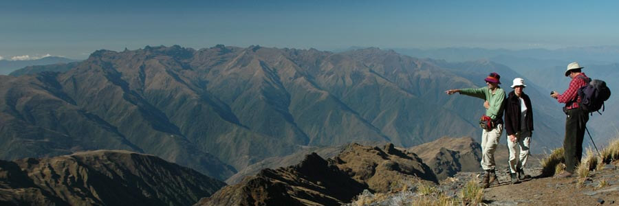
- Splendid views of mountain landscape, the highlands, Lake Titicaca and the rain forest.
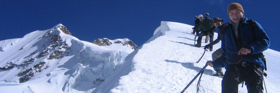
- Trekking contouring Illimani massif, including a visit to the base camp.
- Traversing ancient pre-Hispanic coca leave trading routes.
- 9 days of trekking (74km total distance).
Services Included
- All transfers IN/OUT to airports.
- Meals mentioned in the itinerary.
- Full land transportation during the trip.
- Hotel accommodation as mentioned in the itinerary.
- Common camping equipment: 3 season tents, dinning and kitchen tents & tableware.
- Bilingual guide during the trip.
- Luggage transportation with porters and/or animals (15 kg/33 lb per person max weight).
- Cook when camping.
- National Park entrance fees.
Services Not Included
- International & local flight tickets & fees.
- Meals while in La Paz.
- Personal camping equipment: sleeping bag, mattress, headlamps, and clothing.
- Insurance of any kind.
- Any expense due to a rescue operation (rescuers fee, transportation, or medical cost).
Day to day details
Arriving at the airport in La Paz your breath will be taken away. Not just because of the altitude; the airport is the highest international airport in the world; but also because of the views over the mountains. The crisp clear sky of the highlands give the impression you could touch them. In a normal winter day it is possible to see over a distance of 200Km (120mi). The cold and dry air feels good after so many hours of treated pressurized cabin air.
The drive to the city of La Paz is not less impressive. We will stop at “La Ceja” (literally the eyebrow in Spanish; but also meaning the edge) and have a view on the amazing city with buildings and houses hanging from the steep slopes and filling the whole valley that is surrounded by huge glaciated mountains.
Then we will descend 500m (1640ft) down to our hotel in downtown. Do not get stressed much about the altitude; our program has been designed to get you gradually acclimatized. At the beginning we strongly suggest you to take it very easy, drink plenty of water and eat lightly (get into out Acclimatization page for more information).
You will have the rest of the day free. At early evening we will have a briefing meeting.
Overnight: Hotel Nayra
El Alto: 4,100m (13,450ft)
La Paz: 3,650m (11,972ft)
Driving: 30Min (11km)
None
After breakfast we will take our transport and head north towards Lake Titicaca. Half of the way we will do our first hike in this small rocky range facing Cordillera Real. After the hike we will board our vehicle to get to the shores of the lake where we will stay in one of the best hotels in the area.
Traveling through this land it is easy to understand how important the shores of Lake Titicaca have been in the development of Andean cultures. Surrounded by desert like hills and snowcapped mountains, the lake offered, and still offers, rich lands and a mild climate. On the way to Copacabana, we will be culturally transferred to the past as we go by Aymara villages where Indians have been keeping their lifestyle for centuries.
Overnight: Hotel Rosario del lago
Trailhead: 4,011m (13,156ft)
Peñas: 4,333m (14,212ft)
Lake Titicaca: 3,810m (12,497ft)
Driving: 4-5Hrs (185km)
Walking: 3-4Hrs (4km)
B,L
An early start to make a short but pleasant drive along of the shores of Copacabana peninsula towards the village of Yampupata, there we will board the motor boat that will take us to the Island of the Sun. Today we will trek the whole length of the island admiring the Inca terraces, many of which are still used, passing through villages and walking along sandy beaches. Our objective is to reach the north-west end of the island where we can visit a sacred rock, which was worshipped as the birthplace of the first Incas: MancoKapac and Mama Okllo, son and daughter of Viracocha. We will also have time to visit the ruins of Chincana (the labyrinth). After lunch we will take our motor boat back to mainland and then our vehicle towards La Paz.
Overnight: Hotel Nayra
Island of the sun: 4,065m (13,333ft)
Chincana: 3,830m (12,529ft)
La Paz: 3,650m (11,972ft)
Walking: 3-4Hrs (11km)
Motor boat: 2-3Hrs (13km)
Driving: 4-5Hrs (176km)
B,L
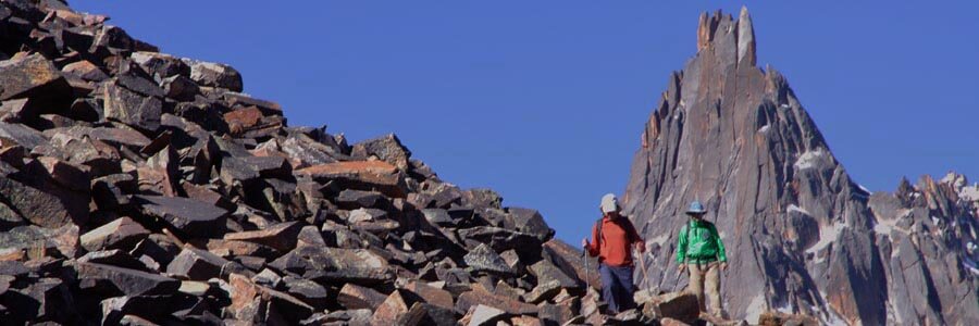
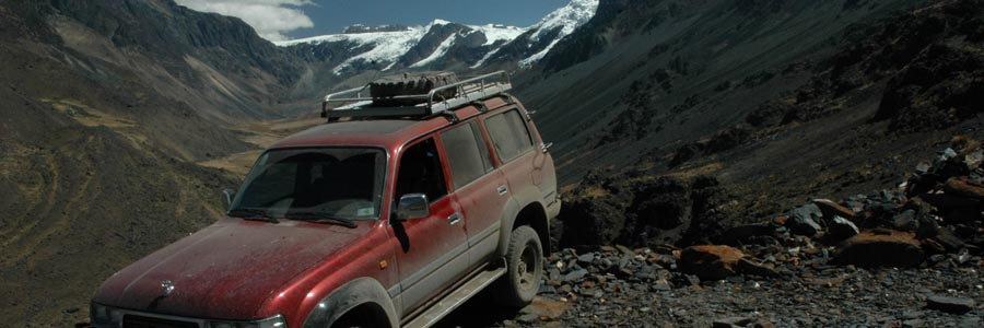
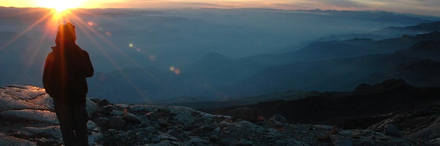
The road towards Pinaya snakes along the ridges and slopes of the southern part of Illimani mountain in Cordillera Real massif, more precisely through the Palca canyons. The continuous change of colors and textures in the mountain sides are amazing to the eyes: the agriculture fields between the canyon faces, the protruding rocks guarding the rivers and the shining glaciers overlooked from the pastures. Pinaya is a typical Aymara Indian village. Our ever smiling porters and mule drivers live there. They worship Illimani as their protector and benefactor. The first part of the trek will be quite steep up to Chapoco; a swampy grassy plain used as a base camp for climbers who attempt this mountain. From this point we will continue on an abandon road towards our campsite located in an old mining campsite. After sunset, a shapeless “ameba” of light appears under the horizon: the city of La Paz.
Overnight: Camping
Palca: 3,468m (11,375ft)
Quiliwaya River: 2,866m (9,400ft)
Pinaya: 3,776m (12,385ft)
Tojra: 4,500m (14,760ft)
Driving: 3-4Hrs (52km)
Walking: 6-7Hrs (9km)
B,L,D
We continue to follow yesterday’s old mining track this morning which takes us over an easy pass before we head downhill and begin towards Uraña mine. This was once a large operation, judging by the disused buildings and machinery and will contrast with the other mining activity we will encounter on our journey – where just a handful of men live rough in the mountains and work fissures on high rock faces. It is difficult to visualize how people could work at these heights and in such a harsh environment. Suddenly the landscape changes dramatically as we descend to the dirty road that we follow until Atawallani village. From this point, we leave the road and start following a path through grassy fields will lead us into a high mountain forest. A small meadow, at the side of a stream will serve us as a campsite. Since we are now on the other side of Illimani we will be able to enjoy twinkling lights of another sort – the fabulous stars and constellations of the southern hemisphere sky.
Overnight: Camping
Kosuma river: 3,584m (11,755ft)
Walking: 5-6Hrs (12km)
B,L,D
A new gold mine has started operations and now the route to our pass is very distinct and it navigates between vertical rock faces and along slopes of scree. The pass itself is but a small notch in a black rocky ridge that runs down from the Illimani massif. The passage is dramatic insofar as we leave one world behind for completely new vistas. Once through, instead of skirting round Illimani we will be facing east towards the cloud forest and spotting Quimsa Cruz mountain range for the first time – and as the mountains get lower and lower, so they get greener. It is also a good spot for sighting condors riding the thermals. We will spend some time exploring and old abandon gold mine at the other side of the pass as we descend towards the bottom of the valley where we will set our campsite. It is even possible to start smelling the perfumes of the forests down below. In the evening before it goes dark you will likely hear what sounds like thunder – in fact it is the dynamite blasts of a small handful of gold miners working on the rocky slopes above.
Overnight: Camping
1st Mnt Pass: 4,550m (14,924ft)
Jokoyo: 3,775m (12,382ft)
Walking: 6-7Hrs (9km)
B,L,D
After ascending to a ridge with superb views of the eastern face of Illimani mountain and the colorful patchwork of cultivated fields where many varieties of crops are cultivated; namely: corn, peas, beans and even fruit trees. Today we will have a long steep descend to the bottom of the valley; certainly our knees will feel it though. As we get lower into the microclimatic valley of Chunga mayo, the vegetation will get thicker and temperature increase. The area is populated by farmers and every year we have to change the spot of the campsite as the farmers switch their crops. Sometimes the difference between one and the other is as much as 1 hour.
Overnight: Camping
Chituwaya: 2,715m (8,905ft)
Walking: 5-6Hrs (9km)
B,L,D
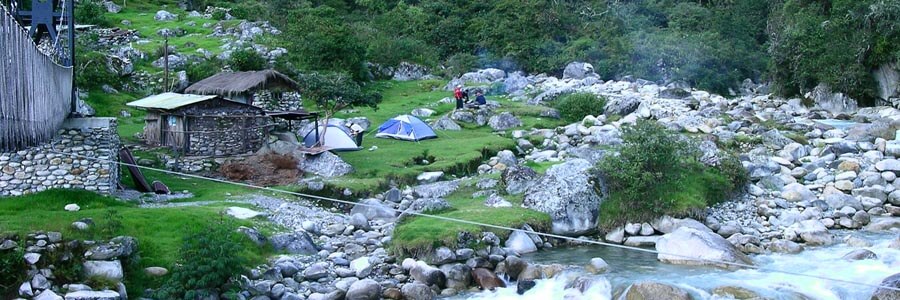
On our way to the next camp we pass by “El Rancho”; a rundown farm of old buildings that probably were part of a more extensive hacienda before the land-reform that followed the 1952 Revolution (the seminal historical event in modern Bolivian history). If we are lucky to find anyone there, we may buy some sweet limes or Chirimoya (custard apples). The former are great to eat simply peeled like an orange – or if you have bought a bottle of Singani (Bolivia’s national spirit) with you, to make a citric rocket fuel aperitif before supper. Later we will ascend to the village of Quircuma and from there still higher up into a hidden valley called Trapiche where we will set our campsite.
Overnight: Camping
Rancho: 2,256m (7,399ft)
Trapiche: 3,600m (11,808ft)
Walking: 5-6Hrs (9km)
B,L,D
A rest day in the forest before going back to the heights. The clear water stream invites to take a bath or wash some laundry.
Overnight: Camping
Trapiche: 3,600m (11,808ft)
None
B,L,D
Today’s climb is not really noticed as the trail takes us into a “lost paradise valley”, the weirdest thing is that the higher we go the most dense the vegetation grows because of microclimatic conditions in this valley. It will fell hot and humid as we pass along ancient pre-Hispanic paths that cut tunnels through the vegetation towards our campsite located on the slopes of “Cerro Khala Ciudad” (the name of this mountain group translating as Stone City). Today we have a long way uphill towards Kasiri lagoon, our route will take us first on a scenic ridge to then drop down to Trapiche meadow which looks like a Jurassic park with grass fields surrounded by trees, ferns, parasitic orchids, bamboo and moss clad trees. In the afternoon we will get back to the altitude lands featured by lakes with vertical rocky shores. The trail gets wider and the cobble stone is in better shape. It is amazing to know that they have been built at least a thousand years ago.
Overnight: Camping
Kasiri lagoon: 3,960m (12,989ft)
Walking: 6-7Hrs (9km)
B,L,D
It is magnificent to walk along the ridge and see that the lower slopes are being covered by jungle forest. Here at the tree line of the cloud forest, there is a lot of wildlife. Look out for bears, they may be laying on the grassy fields, in the shadow of the trees. Clouds obscure the valley bottoms as the rivers drain into the upper reaches of the Amazon Basin. Our camp site will be just below the tree line (Ceja de Monte).
Overnight: Camping
Crest pass: 4,350m (14,268ft)
Solaka: 3,000m (9,840ft)
Walking: 7-8Hrs (12km)
B,L,D
The trail gets narrower as we descend into the cloud forest. At times we will be walking through tunnels of vegetation – as it gets progressively thicker, warm and more humid our lead guides might have to use machetes to clear the way. However, it is not unpleasant and there are good opportunities to spot orchids and birds. We will be descending a ridge and suddenly the cloud forest will give way to cultivated land as we descend towards the Hacienda of Siquilini. The Yungas are the semi-tropical valleys that lie in the eastern foothills of the Bolivian Andes – coca is grown here as it has been for many centuries, although citrus fruits and coffee are also produced. Today the Yungas have become a destination for the wealthier citizens of La Paz to retreat to away from the cold and altitude of the city. We will take our vehicles to go the nearby town of Chulumani.
Overnight: Hotel San Bartolome
Siquilini: 1,829m (5,999ft)
Chulumani: 1,754m (5,753ft)
Walking: 6-7Hrs (14.5km)
Driving: 40Min (8.5km)
B,L
The journey back to La Paz is relatively long, but it is an interesting one as we climb back up and over the Andes once more.
Overnight: Hotel Nayra
Road pass: 4,800m (15,744ft)
La Paz: 3,650m (11,972ft)
Driving: 5-6Hrs (105km)
B,L
Transfer to airport.
Overnight: None
El Alto 4,100m (13,450ft)
Driving: 30Min (11km)
None